Flash Flood Warnings in Colorado: The Critical Role of Flood Mapping in Mitigating Risks
Colorado is no stranger to flash floods, especially during the summer months when intense thunderstorms and sudden downpours can lead to dangerous and rapidly developing flood conditions. As September is approaching, Coloradoans are reminded of the floods in 2013. From September 9 to September 16, 2013, the Front Range of Colorado experienced a catastrophic flooding event caused by record-breaking rainfall. Over a span of just five days, some areas received between 6 and 18 inches of rain, leading to severe flooding in multiple communities. The disaster resulted in nine fatalities, the evacuation of 11,000 residents, and the destruction of 1,850 homes. The extensive damage was estimated at around $4 billion, prompting the designation of 18 counties as federal disaster areas. This catastrophe brought wide-spread awareness to the necessity of proper flood mapping in efforts to protect lives and property.
Understanding Flash Floods in Colorado
Flash floods are sudden and intense flooding events caused by heavy rainfall, rapid snowmelt, or the failure of natural or man-made dams. Colorado’s diverse landscape, with its mountainous regions, valleys, and urban areas, makes it particularly vulnerable to flash floods. The state’s steep terrain allows water to flow quickly into lower areas, often overwhelming natural waterways and drainage systems in a matter of minutes.
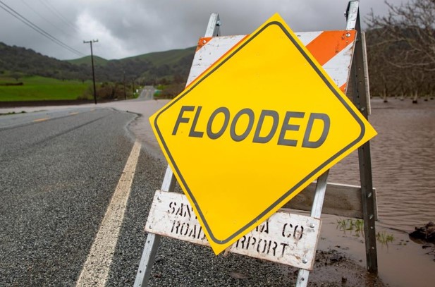
In the past few weeks, Colorado has seen several flash flood warnings issued across the state. These warnings are a crucial tool in alerting residents to the imminent danger of flooding, giving them precious time to seek higher ground or evacuate if necessary. However, the effectiveness of these warnings depends heavily on the accuracy and timeliness of flood mapping.
The Role of Flood Mapping in Flash Flood Warnings
Flood mapping plays a vital role in predicting and managing flash flood risks. Modern flood maps are created using a combination of historical data, topographical information, weather models, and advanced technologies such as Geographic Information Systems (GIS) and remote sensing. These maps provide detailed visual representations of areas at risk of flooding, helping authorities identify vulnerable regions and issue targeted warnings.
In Colorado, flood mapping is particularly challenging due to the state’s varied geography. The rapid changes in elevation and the presence of urban areas with impermeable surfaces complicate the prediction of water flow and accumulation. Accurate flood maps must account for these factors to provide reliable data that can be used in emergency planning and response.
When a flash flood warning is issued, emergency responders and local governments rely on these maps to determine the areas most at risk. This information is crucial for making decisions about where to deploy resources, which areas to evacuate, and how to best protect critical infrastructure.
Technological Advancements in Flood Mapping
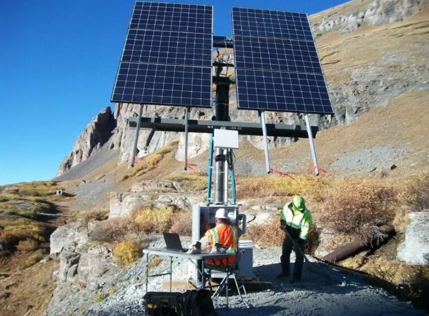
In recent years, technological advancements have significantly improved the accuracy and usefulness of flood mapping. Drones, for example, are increasingly used to capture real-time data on flood conditions, while satellite imagery provides a broader perspective on large-scale weather patterns and their potential impacts on specific regions.
Artificial Intelligence (AI) and machine learning algorithms are also being applied to flood mapping. These technologies can analyze vast amounts of data to identify patterns and predict where flash floods are most likely to occur. By integrating AI with traditional mapping techniques, experts can create more dynamic and responsive flood maps that are updated in real-time as conditions change.
In Colorado, these advancements are being used to enhance the state’s flood preparedness. For instance, areas that have experienced repeated flash flooding are now being closely monitored using real-time data feeds from weather stations, river gauges, and other sensors. This data is fed into flood models that can predict the likelihood of flash floods and help officials make informed decisions about when and where to issue warnings.
Community Awareness and Preparedness
While technology and flood mapping are crucial tools in managing flash flood risks, community awareness and preparedness are equally important. Residents in flood-prone areas need to be aware of the risks and understand how to respond when a flash flood warning is issued. This includes knowing evacuation routes, having emergency supplies ready, and staying informed through local news and weather alerts.
Local governments and emergency services in Colorado have been working to educate the public about the dangers of flash floods and the importance of following evacuation orders. Public information campaigns often use flood maps to show residents the areas most at risk and help them understand why certain actions, such as moving to higher ground, are necessary.
The Future of Flood Management in Colorado
As Colorado continues to face the challenges of flash flooding, the importance of accurate and up-to-date flood mapping cannot be overstated. These maps are the foundation of effective flood management strategies, providing the information needed to protect lives and property.
With the ongoing development of new technologies and the integration of AI into flood mapping, Colorado is better equipped than ever to respond to flash floods. However, continued investment in these technologies, along with community education and preparedness, will be essential in ensuring the state can effectively manage the risks posed by these sudden and dangerous events.
As we move forward, the combination of advanced flood mapping, real-time data analysis, and community engagement will be key to reducing the impact of flash floods in Colorado, helping to keep residents safe in the face of an ever-present natural threat.